Wouldn’t it be wonderful to be able to visually examine the lake bed in order to know its features and all of its peculiarities? Imagine how much easier this would make it to catch your target species of fish.
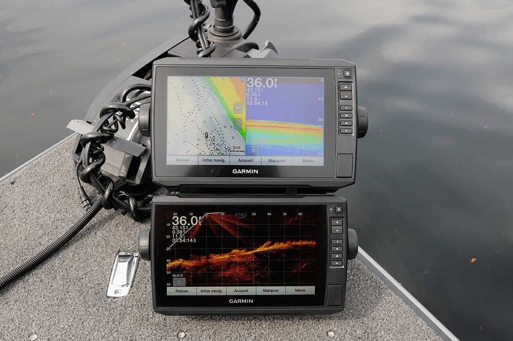
We obviously have very valuable tools like bathymetric maps, GPS and sonar that help us, and it is also possible to dive. Even still, it is difficult to get an overall and accurate picture of the water.
Moreover, if the water is dirty or turned up, the field of vision is considerably reduced. You can also fly over a body of water using an airplane or a drone, to help you discover shallow spots that can be potentially interesting. There are however dozens of clues that Mother Nature offers us to better know our fishing spots. Let’s discover them together.
Step 1 – Observe The Banks
When I was younger, my grandfather, Athanase, said to me phrases like, “We are going fishing here, it must be deeper than elsewhere, it will certainly be productive,” or “Throw your lure in this direction. It’s a lot less deep than that.” I was just amazed. We must not forget that at that time we did not have sonar.
I really thought he was a kind of superhero who could see what was happening underwater. He explained to me a few years later, that he relied on the configuration of the shore to try to predict the underwater architectural composition.
For example, if the shoreline is flat over a thousand meters in length by one thousand meters deep, it is a safe bet that much of the portion of the adjacent waterbody will also be flat and shallow. On the other hand, if there is a mountain flanked at the foot of the lake, there is a good chance that the adjoining portion is very deep.
Just as if you see a point of rock or sand that starts from the shore and continues into the water, there is a good chance that it will continue under the water, gradually fading away. What I learned from Athanase at a younger age is that you have to be creative.
When you look at the forms on the banks and shores, you just have to stretch them as if they were continuing underwater. This totally inaccurate science gives us a little idea of what is going on underwater. Just look at the rugged banks and their irregular shapes to understand that the imaginary extension does not apply every time. I often have fun imagining what’s happening underwater, before looking at my sonar.
Over time, by analyzing and observing, I would say that 7 or 8 times out of 10 I can predict with relative precision, the surrounding underwater structure.
However, I can guarantee that if you do not have a bathymetric map of the water you want to use, this technique can make you proud.
The different materials that make up the shore can also tell you a lot. Unless man has changed it. Think of a beach, it is almost certain that the surrounding seabed will be composed of sand.
Imagine a strike filled with large stones or pebbles we will probably find under the waters nearby. This type of analysis allows you at a glance to learn more about the composition of the seabed.
Step 2 – Locate The Boundaries
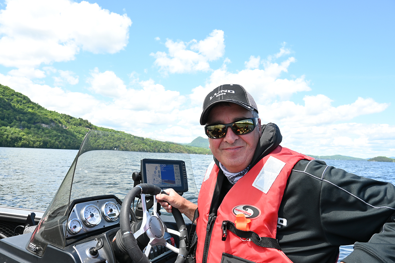
For this step, it is strongly recommended to bring a good pair of polarized lenses. These will eliminate the majority of light reflections on the surface of the water and allow you to see more clearly below the surface.
A dividing line is actually a natural line that allows us to visually separate two areas. This line can measure, according to the clarity of the water and the adjacent depth, a few centimeters to a few meters wide. Think of a beautiful beach. If you stand on the beach looking at the water, it is a safe bet that you will see a visual demarcation.
A change in colour from beige to pale brown to brown to darker colours to finally becoming the same colour as the surrounding waters. This line, rarely straight, clearly indicates an escarpment. This is a natural route that several species of fish such as walleye, pike, bass, muskellunge, lake trout, speckled, etc., will occasionally take to travel and to orient themselves.
This type of direct access to deeper waters greatly appeals to many species of fish. They can migrate easily and quickly from abysses to shallow water hunting sites.
This example is equally applicable if you have a gravelly or rocky area. As soon as there is a visual demarcation, it indicates a fall towards deeper water. If you have an electric motor, I strongly suggest you use it in order to have a subtle approach and not to frighten the fish for miles around.
Start by making long casts with lures such as swimbaits, spoons, tubes, plastics or flies. Do not start trolling because the sound of your engine and boat plowing the waters will precede your lure. After making several throws along the line and on each side of it, you can try your luck on the trail.
Now take the case of weed beds. If they are emerging, we can easily see the boundaries separating open water from vegetation. Even if the transition to deeper waters is
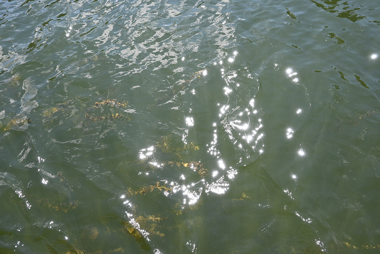
gradual, this is a beautiful natural belt that presents an interesting transition. Several species of fish hide in the weeds to rest, to camouflage themselves to hunt or to feel safe. This natural barrier that opens to open water vegetation is a great fishing spot. Simply use spinnerbaits, grass spoons, etc. to tease the fish that live there.
There are also herbaria and submerged grass lines. A large number of fish, such as speckled trout, walleye, pike, bass and many others will be in this kind of plant structure. On occasion, they will be a few inches under water and at other times they will go deeper. Your polarized lenses will help you locate them visually.
Then, when they disappear from your field of vision, you can use your sonar to continue tracking them. Fishing with a diving Cotton Cordel lure or jigging with soft plastic lures like the Mister Twister, Exude Curly Tail, Sassy Shad, Teenie Meeny, or Double Tail is very productive.
Shallow submerged structures are also relatively easy to locate. This other type of visual demarcation tells us a lot about their presence underwater. Take a subtle approach and exploit these submerged islets in the same way you would exploit the edge of an island.
The demarcation of the colour of the water is another natural factor that must not be ignored. A sudden change in the temperature of the water can create this kind of phenomenon, just like a tributary that pours its coloured waters into a body of water. The transition to a muddy bottom can also create a visible line.
Fodder fish often favour this type of sector in order to camouflage themselves. Casting a swimbait will let you know if the big predators are in the area.
Step 3 Analyze Any Currents
This ecological factor found mainly in rivers and streams, as well as near dams and tributaries offers environments that differ from those of the calm waters of traditional lakes.
In the current, anything that deviates, slows or reorients the flow of water, represents a potentially productive fishing spot. In fact, any obstacle that interferes at all with the flow of water could actually be a potential habitat for those you hunt with your fishing rod.
It makes sense that fish living in whitewater must do much more work than their lake-dwelling cousins. They must continually confront the torrents that sweep around their habitat. To rest or hide for the purpose of hunting prey, fish opt for natural barriers. All rocks, pits, surf, etc. are places to be protected from the ever-changing body of water. If you are an athlete, you can certainly practice your favourite activity for several hours.
But after a while, you must stop to rest and gain strength. It’s exactly the same for fish. They cannot constantly hover in the current or eternally deploy their energy to maintain their position. It must also be taken into account that the degree of resistance that each species of fish can tolerate varies considerably.
At a glance, you can usually see the water moving from upstream to downstream. The moving waters cause small waves. The surface of the water will not be perfectly uniform. It will reflect light, just as if you were taking a sheet of aluminum foil, compacting it into a ball, then unfolding it again. This phenomenon is called “crumpled mirror”. Then, in places where the current is interrupted, you will often find less agitated waters nearby.
The surface will generally be almost uniform. This can be referred to as a “perfect mirror” or a “near perfect mirror”. If the current is strong enough, it is possible that vortices and/or surface waves are created. Moreover, rocks or obstacles on the bed of a river with more than one meter of water over them will create zones of calm water behind them, even if we do not see them from the surface.
The best way to exploit whitewater is to target areas of calm. Cast your lure a few meters upstream of the targeted location. Watch as the current carries it. When it reaches this extraordinary fish habitat, be sure to swim it in this lull zone. Sometimes the fish will be very close to the obstacles. Try your luck a few times to make sure you have covered the whole structure before moving on.
Step 4 – Go to Warmer Places
If you swim in a lake, you will occasionally feel warmer and colder currents. Underwater springs, bottom or surface currents, winds, etc. can have an impact on the water temperature.
Water temperature has a direct impact on fishing at the beginning of the season. In the spring, shallow bays, places near sandy or gravel beaches, places with lots of rocks and or cliffs, are places that warm up faster in early spring. All these solar collectors store the heat of the sun and then spread it for long hours.
Early season bays will often be 3, 4 and even 5 degrees Celsius higher than the rest of the main body of water. Several species will then take the opportunity to warm up the rind.
At a glance, you will be able to decipher and recognize which areas may be more comfortable for the species you are hunting.
Step 5 – Look for Shaded Areas
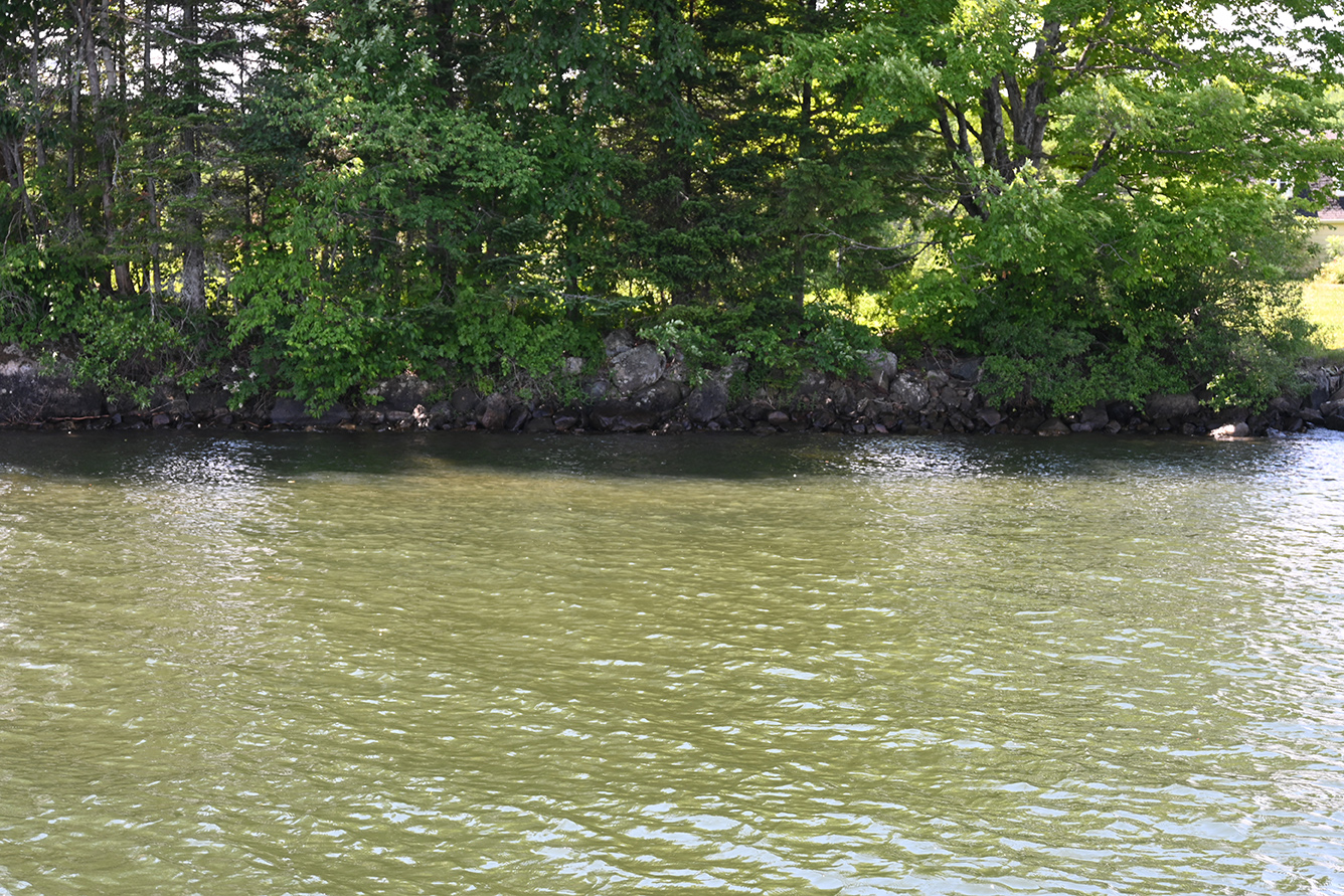
Several sites like cliffs, mountains, rocky escarpments, etc. provide shade from the sun. Trees, as well as several types of human creations such as docks, boathouses, bridges, etc., will also create shade.
The wonderful thing about these locations is that some fish species will take advantage of them to protect themselves from direct sunlight. In addition, the surrounding waters may be slightly more temperate due to the shade. Many species will feel safe and secure, and they can easily camouflage themselves to ambush potential prey. It should also be noted that many insects and fish that form the lower class of the food chain will also frequent these areas, to the delight of predators.
Try your luck. There are often beautiful specimens of all species.
Summary
A body of water is actually an open book that is ready to give you all of its’ secrets. It only asks for a little attention and observation. There are of course sonars and GPS that are there to support and guide you.
Remember that the pace of our modern lives plunges us into a world of constant stress. When fishing, loosen your seatbelt a bit, breathe and enjoy relaxing. Afterward, admire the beauties that nature offers us so generously. You can easily discover its secrets if you take the necessary time.
Patrick Campeau is a professional fisherman that is a three-time provincial champion member inducted into the Canadian Pantheon of Fishing.
Find out more about Patrick Campeau at www.pcampeau.com or www.facebook.com/lapassiondepatrickcampeau
Keyword : angler, bass, best boat, Best boat buying website, best boat marina website, best boat travel website, best place to rent a boat, boat, boat accessories, boat angler, boat boondocking, boat buyers guide, boat camper, boat camping, boat dealers, boat DIY, boat Fishing, boat Fixer, boat Home, boat information, boat insurance, Boat Maintenance, boat marinas, boat marinas in Alberta, boat marinas in BC, boat marinas in Canada, boat marinas in Manitoba, boat marinas in Saskatchewan, boat marinas in the USA, boat marinas near me, boat products, boat rentals, boat repair, boat road test, boat sharing, boat sites near me, boat supplies, boat Tech, boat tips, boat touring, boat trade, boat Travel, boat traveling, boat travelling, boat vacation, boat vacation cost, boat websites Canada, Boating, boating Canada, Boating Canada’s Boat Lifestyle Magazine, Boating Lifestyle Magazine, boating website, Canadian marina websites, expert boat information, find a boat dealer, fishboat, fishing, fishing tips, fishing tricks, how much does a boat cost, how much does marina cost, how to choose a boat, how to drive a boat, marina products, marina supplies, motor boat, Perch, power boating magazine, reel, salmon, top boat website, trout, used boat reviews angler, bass, best boat, Best boat buying website, best boat marina website, best boat travel website, best place to rent a boat, boat, boat accessories, boat angler, boat boondocking, boat buyers guide, boat camper, boat camping, boat dealers, boat DIY, boat Fishing, boat Fixer, boat Home, boat information, boat insurance, Boat Maintenance, boat marinas, boat marinas in Alberta, boat marinas in BC, boat marinas in Canada, boat marinas in Manitoba, boat marinas in Saskatchewan, boat marinas in the USA, boat marinas near me, boat products, boat rentals, boat repair, boat road test, boat sharing, boat sites near me, boat supplies, boat Tech, boat tips, boat touring, boat trade, boat Travel, boat traveling, boat travelling, boat vacation, boat vacation cost, boat websites Canada, Boating, boating Canada, Boating Canada’s Boat Lifestyle Magazine, Boating Lifestyle Magazine, boating website, Canadian marina websites, expert boat information, find a boat dealer, fishboat, fishing, fishing tips, fishing tricks, how much does a boat cost, how much does marina cost, how to choose a boat, how to drive a boat, marina products, marina supplies, motor boat, Perch, power boating magazine, reel, salmon, top boat website, trout, used boat reviews
