
By Mark King
from issue 27-3
Charting your course for safe navigation
Several years ago I was fortunate to be able to enjoy a glorious Thanksgiving weekend docked on the south-west end of Constance Island in the Thousand Islands. The weather was perfect – cool nights made for pleasant sleeping under thick blankets and the sun came out each day, warm enough for shorts and tee shirts.
Of course, the excellent day-time weather also brought people out for a final cruise through the islands. The area where this island is located is among what is considered the most beautiful part of the islands and it is an area where everyone likes to cruise, so the boat traffic was relatively heavy during the day.
What makes the islands a unique cruising experience – rocky outcroppings popping out of the water, and twisting, turning channels – also makes it important to pay attention when you’re navigating through the area.
The channels are full of currents and just below the surface, jagged shoals reach up to give a Thousand Islands welcome to unwary boaters. In the islands, the Thousand Islands Association marks the location of shoals with white shoal markers. They place them in the vicinity of the highest portion of the shoal in spring and pull them out after Thanksgiving.
Across the channel from the Constance Island dock, one such shoal marker highlights the top portion of a particularly long and nasty shoal. It wasn’t long before we heard and saw the “whump-thump” of a fibreglass bottom cruising calmly onto the rocky leading edge of the shoal.
To shorten this story, that weekend was similar to The Athens Queen by Stan Rogers. We all waited patiently on the dock for another boat to hit “Ripper Rock.” It happened half a dozen times altogether. And there was nothing we could do to stop it. It was too far away to yell or signal. All we could do was wait and watch. Thankfully, no one was cruising too fast so damage from all these events appeared to be minimal, and no one was hurt.
But it all could have easily been avoided.
One of the safe boating rules that boaters must learn before acquiring their Pleasure Craft Operators Card is that the latest charts and publications must be on board the boat unless you have “local knowledge.”
It was obvious that all the folks who hit this shoal, and those who came so close you could place bets, didn’t have local knowledge. So, their charts should have saved them. I’m betting they didn’t have them on board, or they were tucked away in a locker because: “I’ve cruised through here lots of times before.”
Charts, even old charts of this area, a knowledge of what charts tell you and how to read them, and a listen to the Coast Guard marine forecast for the day that explains in plain language what the water levels are in that area, would have told all these boaters that water levels were low and the tops of the shoals were a lot closer to the surface than they had been all season.
Over the next couple of columns I am going to spend some time explaining what navigation charts are, the information they contain and how to interpret that information, and then I will also explain a little bit about other publications that you should have on board.
If you’re using an electronic navigating system, such as a GPS and chart reader, don’t turn the page. Those systems would also not tell you the shoals were closer to the surface that day. They also require interpretation. They are subject to failure. And they do not let you off the hook of the legal requirement to have charts and publications on board and know how to read them.
So what is a nautical chart anyway?
Put simply, a nautical chart is a graphical representation of an area and it is used by boaters for the purposes of navigation. It will show water and water depths, details of the shore-side land structures as well as man-made and natural aids-to-navigation, magnetic compass readings, distances, and the type of bottom, among other items.
Since man first started navigating he has made maps or charts to pass along to others.
Now, the Canadian Hydrographic Service does all this work, compiles it in an easy to understand fashion, and updates it regularly. Modern technology has advanced this art to the point where in some places you can download and print commercially available charts the night before you leave on a trip with all the latest updates included.
But I leap ahead.
Position on any chart is based on latitude and longitude. Each degree of latitude – the measure from the equator to the poles – equals what is referred to as 60 Minutes. One Minute equals one Nautical Mile. And a Nautical Mile equals 6076.6 feet, or 1,852 metres.
Charts are developed on a scale. If the chart represents a large area, it is a small scale chart. If the chart covers a small area, it is a large scale chart.
Now here comes tricky part. Charts are flat. The earth is curved.
In order to represent lines of latitude and longitude as straight and square – so that we can plot – our charts are what is called a Mercator projection.
If you saw an overall chart of the world on a Mercator projection you would note that the spacing of the lines of latitude increases as you move toward the poles. This is why on these large maps of Canada, the northern part of the country seems much larger than it does when viewed on a globe.
This is also why it is important to the latest, largest scale charts on board. They will be the most accurate. And, they will contain the most detail.
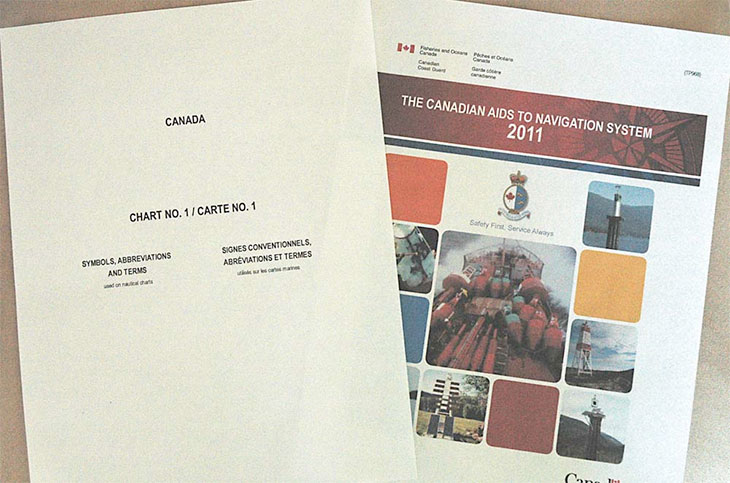
To wrap up this column I want to introduce you to two important publications from The Canadian Hydrographic Service.
Chart 1 contains a definition and description of every symbol and notation made on Canadian charts. The Canadian Aids to Navigation System describes aids to navigation used in Canada that you will find depicted on charts.
If you don’t have them, an adequate copy can be printed from the Canadian Hydrographic Service Website. Chart 1 is available here
In the next column, I’ll walk you through their relationship to your nautical charts, paper and electronic.