
Often referred to as ‘Google maps for boats’ – navigation app savvy navvy rolls out much-requested Over the Horizon AIS feature.
Press Release – Marine technology company savvy navvy has rolled out Over the Horizon AIS (OHA) in its latest app update. OHA uses the phone’s internet connection to stream other vessels’ locations in real-time directly to the app, improving safety on the water. 
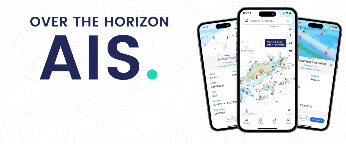
Traditional AIS received from the transceiver on the boat has a range of a few miles, whereas OHA can provide the user with vessels further afield, even those ‘over the horizon’. While OHA does require an internet connection, it has the added advantage that boaters don’t need additional hardware to see information on vessel movements globally.
“Not all boaters have AIS hardware on their boats. In fact, a recent study found that depending on the vessel type, 30 percent of boaters, and in some cases even as much as 75 percent, do not own AIS transceivers. But all of these boaters could benefit from Over the Horizon AIS to be able to see what’s around them and stay safe. This is why we prioritized the launch of OHA for our users. It’s all about making AIS more accessible to anyone on the water,” says Jelte Liebrand, Founder and CEO of savvy navvy.
Over the Horizon AIS will allow savvy navvy users to see vessels directly on the chart with small and large vessel crafts clearly defined by different colours. Users can also check how crowded the anchorage might be – either from onboard or while planning routes at home.
For navigational safety, the savvy navvy app also highlights when no position has been received for more than 30 seconds. Clearly marking the positional variance area around each vessel allows users to be extra vigilant in their navigation.
“Our latest development will enable savvy navvy users around the globe to see areas of greater traffic and keep track of vessel locations around them for increased safety as one of their navigation tools. We’re pleased to hear how well it’s already been received,” adds Jelte Liebrand. 
Savvy Navvy – often referred to as ‘Google Maps for boats’ – offers a revolutionary, easy-to-use app that brings everything you need for a seamless boating experience, all in one place. Built from the ground up using official hydrographic data, savvy navvy solves many on-water navigation issues for boaters, kayakers, paddle-boarders and jet-skiers. Offering clutter-free charts and smart routing – savvy navvy continues to expand in Canada and the US market, and today has had over 1.5 million downloads from users in more than 100 countries.
To find out more about savvy navvy and all its features visit www.savvy-navvy.com.
Available on Android, IOS, PC and Mac, savvy navvy and can be used on multiple devices and is available in both free and “premium” options with enhanced access and functionalities.
Keyword : AIS, boating apps, Boating Innovation, boating navigation, boating technology, google maps, Maps, marine technology, Over the Horizon, savvy navvy, vessel navigation AIS, boating apps, Boating Innovation, boating navigation, boating technology, google maps, Maps, marine technology, Over the Horizon, savvy navvy, vessel navigation